 Kotor City Guide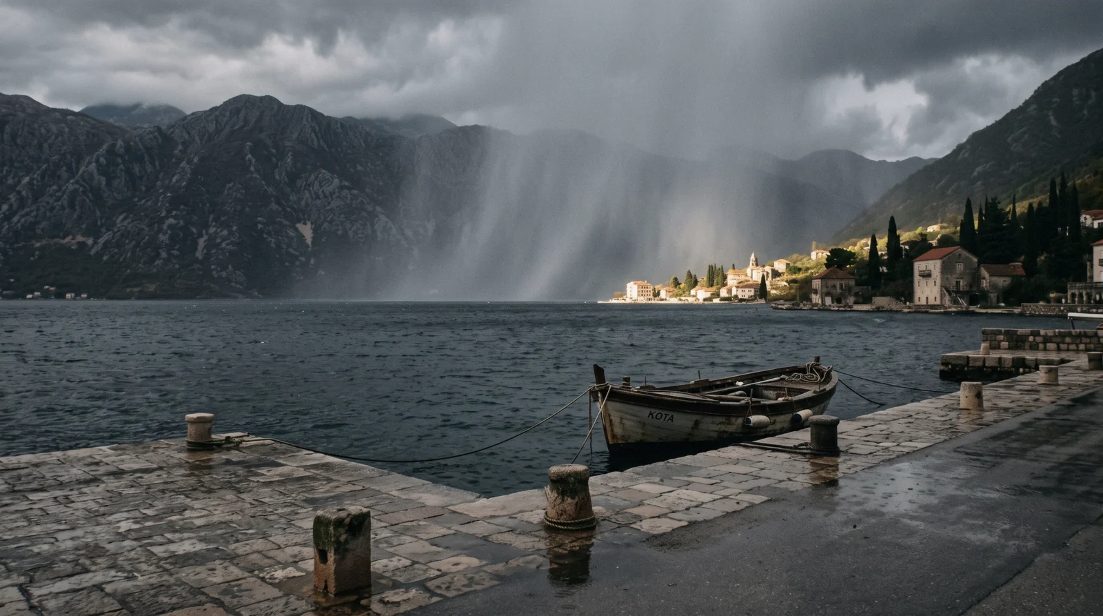
Kotor Weather: a Bay That Makes Its Own Climate
Kotor weather is made by the mountains that wall in the bay. Kotor's weather is not a coastal Mediterranean average copied from a map. The bay sits at the end of a 28 km inlet walled in by two Dinaric massifs, Orjen to the west and Lovćen to the east, and those mountains make most of the weather you will feel. Summers are hotter than the sea suggests, because the same walls that block the wind also trap the heat over the town. Winters are far wetter than the coast deserved, because moist air from the Adriatic hits those mountains and drops its load. This page gives you the measured numbers for the town itself, month by month, and explains what they mean for the walls climb, the boat tours and the beach. For a wider view of choosing a season, see the best time to visit Kotor. The full guide lives on Kotor City Guide.
Quick answer The answer first, then the details that decide it
Kotor has hot summers and a wet, mild winter. The hottest months are July at an average high of 29.6 C and August at 29.7 C. The wettest month is November at 354 mm of rain, followed by December at 313 mm and January at 237 mm. The driest month is July at 62 mm. June and September are the balanced choices: warm enough to swim, well under half of the winter rain, and fewer crowds than August. Winter visitors get calm, cool days with average January highs of 10.9 C and lows of 5.0 C, plus the lowest prices of the year. Whatever the season, the practical rule is the same: the mountains behind the bay set the weather, so mountain day trips need a warmer packing list than the town does.
Key takeaways
- The next stop after this page: None.
- The full guide lives on Kotor City Guide.
- The full guide lives on Kotor City Guide.
The Seasons at a Glance
The figures below are ERA5 reanalysis normals for Kotor covering 1995 to 2024, computed from the Open-Meteo archive. They are measured averages for the town itself, not guesses from a climate map. Average highs rise from 10.9 C in January to 29.7 C in August, and the average low in midsummer is a warm 22 C, which means evenings stay mild on the waterfront. The mountain tops tell a different story, and the difference matters more than any single month's figure.
Winter: December to February
Winter in Kotor is mild by European standards but very wet. December averages 313 mm of rain and January 237 mm, with daytime highs around 10.9 C to 12.3 C. Snow in the town is rare enough that no monthly snowfall figure is published in our sources. The season belongs to the mountains: Orjen's Veliki kabao summit, at 1,894 m, records about 6,250 mm of precipitation a year, one of the wettest stations in Europe, and much of that falls as winter snow above the bay while rain falls on the town.
Practical winter travel: the old town squares and the cathedral need no sunshine, the Maritime Museum runs short winter days from mid October, and this is the cheapest time to book a room in town. If the weather turns, our rainy day in Kotor page has the indoor route.
| Month | Avg high | Avg low | Rain |
|---|---|---|---|
| December | 12.3 C | not stated | 313 mm |
| January | 10.9 C | 5.0 C | 237 mm |
| February | 11.9 C | not stated | 240 mm |
Spring: March to May
Spring climbs steadily. March averages 14.4 C, April 17.9 C and May 22.5 C on the highs, while rainfall falls month by month from 201 mm in March to 174 mm in April and 152 mm in May. The bay is green, the cruise season is running, and the town is noticeably quieter than summer.
Two cautions. First, May can still deliver a soaking day, so keep an indoor option in your Kotor itinerary. Second, the walls path holds water after heavy rain and the stone gets slick, so the 1,350-step climb to San Giovanni fortress is best saved for a dry morning.
| Month | Avg high | Avg low | Rain |
|---|---|---|---|
| March | 14.4 C | not stated | 201 mm |
| April | 17.9 C | not stated | 174 mm |
| May | 22.5 C | not stated | 152 mm |
Summer: June to August
Summer is hot and mostly dry. June averages 26.8 C, July 29.6 C and August 29.7 C on the highs, and nights hold at an average low of 22.0 C in July and 22.3 C in August. Rain drops to its yearly minimum: 96 mm in June, 62 mm in July and 84 mm in August.
The catch is exposure. The walls path has no shade, the operator's own note tells you to bring water, and a midday climb in August heat is a poor plan. Swim instead: the waterfront slabs along Kotor and Dobrota have calm, deep, clear water, though there is no sandy beach in town and no shallow entry.
For a sandy beach day, the beaches around the bay such as Trsteno and Plavi Horizonti on the Tivat side are the answer.
| Month | Avg high | Avg low | Rain |
|---|---|---|---|
| June | 26.8 C | not stated | 96 mm |
| July | 29.6 C | 22.0 C | 62 mm |
| August | 29.7 C | 22.3 C | 84 mm |
Autumn: September to November
September is the second-best month of the year: an average high of 24.9 C and 207 mm of rain, warm sea, and the tail of the cruise season, with about 41 of Kotor's roughly 523 calls in 2026 landing in that month. October cools to 20.9 C with 229 mm of rain, still swimmable on good days. November turns decisively wet at 354 mm, the wettest month of the year, with a high of 16.3 C. That is when the mountain effect is at its strongest and when you plan each day around the sky rather than the temperature.
| Month | Avg high | Avg low | Rain |
|---|---|---|---|
| September | 24.9 C | not stated | 207 mm |
| October | 20.9 C | not stated | 229 mm |
| November | 16.3 C | not stated | 354 mm |
Kotor by Month: Full Table
This is the complete monthly picture for Kotor, from the same ERA5 1995 to 2024 normals. Highs and lows are in Celsius with a Fahrenheit gloss. Where our sources record only some months' lows, the missing cells say so rather than guessing. The rain column is a monthly total in millimetres. Read it alongside our costs page, because the wet months are also the cheap months.
Every Month, Every Figure
Three patterns stand out. The rain curve is a single deep valley in July and two peaks, one smaller in spring and one much larger in late autumn. The temperature curve is a broad summer plateau from June to September with highs above 24 C. And the gap between town and mountain widens in winter, when the 6,250 mm a year that falls on Orjen's summit is falling as snow while Kotor sees rain at 12 C. Note the comparison: the town's wettest month, November at 354 mm, is roughly a third of what Veliki kabao collects in an average month of its wet season.
Nothing in Montenegro's lowlands is remotely that wet.
| Month | Avg high | F | Avg low | F | Rain mm |
|---|---|---|---|---|---|
| January | 10.9 C | 51.6 F | 5.0 C | 41.0 F | 237 |
| February | 11.9 C | 53.4 F | not stated | not stated | 240 |
| March | 14.4 C | 57.9 F | not stated | not stated | 201 |
| April | 17.9 C | 64.2 F | not stated | not stated | 174 |
| May | 22.5 C | 72.5 F | not stated | not stated | 152 |
| June | 26.8 C | 80.2 F | not stated | not stated | 96 |
| July | 29.6 C | 85.3 F | 22.0 C | 71.6 F | 62 |
| August | 29.7 C | 85.5 F | 22.3 C | 72.1 F | 84 |
| September | 24.9 C | 76.8 F | not stated | not stated | 207 |
| October | 20.9 C | 69.6 F | not stated | not stated | 229 |
| November | 16.3 C | 61.3 F | not stated | not stated | 354 |
| December | 12.3 C | 54.1 F | not stated | not stated | 313 |
Why the Bay Makes Its Own Weather
Kotor's climate is a mountain product with a sea address. Understanding the two walls behind the bay explains almost every quirk you will notice on the ground, from the 6,250 mm falling on Orjen to the heat that sits over the town on still August afternoons.
Orjen: The Rain Machine to the West
Orjen is a limestone massif rising straight from the bay's western shore to Veliki kabao at 1,894 m. That single summit records about 6,250 mm of precipitation a year, which puts it among the wettest measuring stations in all of Europe. The mechanism is simple.
Warm, moist air moves in from the Adriatic, hits the mountain wall and rises. Rising air cools, and cooling air drops its water. Most of that load lands on the mountain, and much of it arrives in autumn and winter, which is exactly when Kotor's rain figures spike.
The practical takeaway for visitors is that the wettest months on the coast are the snowiest months up there, and the bare karst of the upper mountain drains fast. A wet November afternoon in town often means clear views from the ridge above the cloud.
| Station | Elevation | Precipitation per year |
|---|---|---|
| Orjen, Veliki kabao | 1,894 m | about 6,250 mm |
| Kotor town | sea level | 1,846 mm (our sum of monthly figures) |
Lovćen: The Wall to the East
Lovćen rises to the east of the bay and completes the bowl. Its slopes carry the famous serpentine road, 25 hairpins above Kotor, and the cable car that climbs to the Krstac ridge. In weather terms, Lovćen does two things.
It shelters the innermost bay from some of what the open Adriatic sends, which is one reason the water at the head of the bay stays calm and clear enough for swimming off stone slabs. And it, like Orjen, catches orographic rain, feeding the short rivers and the Škurda gorge that runs right above the old town. The cable car's own rules make the mountain weather visible: the gondola closes for wind or maintenance with little notice, so a blue morning in the square is no guarantee the top station is running.
| Mountain | Side of bay | Role in the climate |
|---|---|---|
| Orjen | West | Catches Adriatic moisture, among Europe's wettest stations at about 6,250 mm a year |
| Lovćen | East | Shelters the inner bay, carries the serpentine and the cable car, closes to the gondola on wind |
The Fjord Effect
The bay itself is a ria, a drowned river valley of the vanished Bokelj River, about 28 km long, up to 60 m deep and walled by 107.3 km of shoreline. At its narrowest, the Verige Strait is only 340 m wide. Water that deep between walls that steep behaves like a heat store in summer and a cool blanket in the shoulder season.
It moderates the town's nights: the July average low of 22.0 C means evenings on the waterfront stay warm without the inland chill. It also explains the swimming quality visitors comment on, since the calm, deep water clears itself in a way shallow bays do not. No sandy beach exists in Kotor town, a plain fact of the geography, and the swimming that happens here happens off quays and slabs.
Summer Heat on the Walls
1,350 Steps With No Shade The options compared here are exactly the ones this page's cards and the gate prices cover. The euro figure is the official one; the dollar gloss converts at €1 = $1.14.
| Climb | Steps | Rise | Time up | Ticket |
|---|---|---|---|---|
| Walls to San Giovanni | about 1,350 | about 280 m | 45-60 min | €15 ($17.12) main season |
| Ladder of Kotor | not steps | to about 940 m pass | not stated | free |
Figures trace to the gate prices and cards on this site. Figures current in Q3 2026.
The Wet Months and What Still Works
From September onward the rain curve climbs steeply, peaks in November at 354 mm and eases only in spring. A wet holiday here is still a good one, if you plan around it.
November Is the Wettest Month
November's 354 mm is more than five times July's 62 mm. The cause is the mountain effect in its strongest form, as the sea is still warm and the first cold air from the interior wrings it out over Orjen and Lovćen. Days average a high of 16.3 C, so it is rarely cold, but expect days when the sky never properly clears.
The town rewards wet weather better than most: the cats' corners and small museums of the old town, a long lunch in a konoba, and the covered comfort of a day cruise on the bay, where the ship has a roof even if the cave leg is off.
| Month | Rain mm | Compare with July |
|---|---|---|
| September | 207 | 3.3 times |
| October | 229 | 3.7 times |
| November | 354 | 5.7 times |
| December | 313 | 5.0 times |
Boats, Caves and Weather Windows
The sea decides the boat days. The Blue Cave sits on the Herceg Novi side of the bay's entrance, reachable only by water, and every operator listing carries the same condition: the cave leg runs subject to weather and sea state. Since the 2026 season change, boats no longer enter the cave at all, and visitors swim in from the mouth when the skipper judges the swell safe.
In a rough sea, skippers divert to the submarine tunnel at Rosa or add swim time in the bay's lee. The full-day Boka Bay cruise states the rule openly, as does the speedboat circuit from Kotor. The lesson for planners is to book boat days early in your stay, so a washed-out day can be moved, and to keep the walls and the museums as wet-weather reserves.
| Weather condition | What closes | What still runs |
|---|---|---|
| Rough sea at the bay mouth | Blue Cave swim leg | Bay cruise, Perast, submarine tunnel |
| Strong wind | Cable car gondola, closes with little notice | Old town, museums, fortress |
| Heavy rain | Walls path (slick stone) | Museums, cathedral, food tour, covered cruise |
Winds: What the Sources Actually Say
The Adriatic is famous for named winds, and a lot of travel copy imports those names wholesale. Our sources for this page are more modest. What they state is that the cable car gondola closes for wind, sometimes with little notice, which tells you that gusts on the Krstac ridge are a real operational fact, and that ships arriving through the 340 m Verige Strait can stack up and slip their arrival times when traffic and conditions combine.
Beyond that, the sources gathered for this guide do not publish a wind climatology for the town itself, so we print no wind names and no wind frequencies here. If wind matters to your plan, check the gondola's same-day status on the morning rather than the averages.
Choosing Your Month
Weather is only half the decision. The other half is crowds, cruise traffic and price. This section lines them up and points at the pages that own each topic.
The Balanced Picks: June and September
June pairs a 26.8 C average high with just 96 mm of rain. September pairs 24.9 C with 207 mm, sea at its annual warmest for swimming and the longest evenings of the shoulder season. Both sit outside the peak crush, though September carries heavy cruise traffic, with about 41 calls in the month and the town's squares busiest on the big-ship days.
If your dates are fixed by flights into Tivat airport, which sits about 5 km from Kotor, either month gives you the full bay experience without the August heat. For a structured plan around these months, start with our itineraries.
| Month | Avg high | Rain mm | Character |
|---|---|---|---|
| June | 26.8 C | 96 | Warm, dry, before peak crowds |
| September | 24.9 C | 207 | Warmest sea, busy with cruise calls |
If You Want Heat and Parties
July and August deliver 29.6 C and 29.7 C average highs, 62 mm and 84 mm of rain, and the liveliest evenings in town at a 22 C average low. It is the season for swimming, night events and the fullest events calendar, covered on our Kotor events and Kotor at night pages. The costs rise with the temperature, which our Kotor costs page breaks down, and the walls climb and the fortress steps demand an early alarm.
Book accommodation well ahead, whether a hotel, an apartment or a hostel bed.
If You Want Quiet and Low Prices
November through February is the value season. Rainfall is high, especially November at 354 mm, but the mild 10.9 C to 16.3 C average highs of the winter months make sightseeing comfortable, and the town is at its emptiest. The fortress winter price drops to about €8 reported, museums run their short-day winter season, and the tourist information point by the Sea Gate and on Arms Square, where English is widely spoken, can confirm same-day openings.
Days out still work: the cable car on a clear winter day, the bay towns by bus, or the whole-country day trip south to Durmitor for snow you will never see at sea level. If the question is whether the town earns a cold-season visit at all, our honest answer is on is Kotor worth visiting.
Packing by Season
Three lists cover the year. In summer: water bottle for the walls, sun protection, swimwear, and a light layer for evening boat trips when the covered ship moves and the breeze picks up. In the wet months: a proper rain shell and shoes with grip for wet limestone, because the old town's polished stones and the walls steps stay slick after rain.
On mountain days in any season: a warm layer. The operator of the Durmitor day trip says it in four words, bring warm clothing even in summer, because Durmitor sits a climate zone above the coast, and the same logic applies to the Krstac ridge by cable car. For a fuller kit list tied to activities, see things to do in Kotor.
Weather and the Rest of Montenegro
Kotor's numbers are one corner of a country with a large vertical range. Two directions matter to visitors, and each has its own page.
Up: The Mountains and a Different Climate
Drive two hours north and you leave the Mediterranean entirely. Durmitor National Park sits high enough that its summers are cool and its winters are deep-snow ski country, which is why the day trip operator tells even July travellers to pack warm clothing. The one-day version is the Durmitor, Tara and Ostrog monastery day trip, thirteen hours covering the peaks, Black Lake, the Tara canyon and a cliff-face monastery, with pickups from Kotor, Budva or Tivat.
It is the fastest way to feel Montenegro's altitude with your own skin. The white-water alternative is rafting the Tara, and the canyon's depth and cold water are the same mountain climate at work.
| Place | Climate character | Day trip from Kotor |
|---|---|---|
| Kotor town | Hot dry summers, wet mild winters | not applicable |
| Durmitor | A climate zone above the coast, warm clothing even in summer | 13 hours on a guided day trip |
| Orjen summit | About 6,250 mm of precipitation a year | not stated |
South: The Open Coast
Round the headland toward Budva the landscape opens, the beaches turn sandy and the weather feels slightly more exposed to the open Adriatic. The road link is short, covered on our Kotor to Budva page, and the famous islet of Sveti Stefan sits just beyond. The practical difference for planning is beach quality rather than temperature: both towns share the same hot summer pattern, but Budva and the Jaz beach on that road give you sand and shallow entry that Kotor town's stone slabs do not.
Expect the same July and August heat, the same low rainfall, and noticeably bigger crowds.
Tours That Fit the Weather
Two tours belong on a weather page: one that escapes the coastal climate entirely, and one whose headline stop depends on the sea state. The platform bills in your own currency, and the prices below are its US dollar listings.
Prices are the platforms' own US dollar listings and reviews are the platforms' own.
Where the Weather Happens
A map of the bay's weather-makers rather than its sights. The two mountain massifs and the narrow strait between them explain the figures on this page. Exact pin coordinates for the summit and ridge points are not stated in our sources, so the pins carry names and notes.
Plan Around the Sky
Weather is one input. These pages carry the decisions it feeds.
Kotor Weather: Questions and Answers
What is the best month for Kotor?
June and September are the strongest all-round choices. June averages a 26.8 C high with only 96 mm of rain, and September offers 24.9 C, the warmest sea of the year and the longest evenings, though it carries about 41 cruise calls in 2026 so the town fills on big-ship days. For the full breakdown of trade-offs, see our best time to visit Kotor page.
Does it rain a lot in Kotor?
Yes, by Mediterranean standards it does, and the reason is the mountains. November is the wettest month at 354 mm, December follows at 313 mm, and even January records 237 mm. Orjen's Veliki kabao summit collects about 6,250 mm a year, among Europe's wettest stations, and the same air that drenches the mountain waters the town. Summer is a different story: July averages just 62 mm.
How hot does Kotor get in summer?
July and August average highs of 29.6 C and 29.7 C, with nighttime lows of 22.0 C and 22.3 C, so evenings stay warm on the waterfront. The walls climb to San Giovanni fortress has no shade, so go early in the morning and carry water. On the hottest afternoons, the water and the museums are the sensible plan.
Can you swim in Kotor in October?
Often, yes. October averages a high of 20.9 C, the sea holds its summer warmth into the month, and swimming happens off the stone slabs and quays of the Kotor and Dobrota waterfront, where the water is calm, deep and clear. With 229 mm of rain in the month, pack for a mix of swimmable and wet days rather than a beach week.
Does it snow in Kotor?
Snow in Kotor town is rare enough that our sources publish no monthly snowfall figure for it. Winters are mild and wet instead, with January highs of 10.9 C and lows of 5.0 C. The snow falls on the mountains above the bay, on Orjen's 1,894 m summit and in the north of the country, which is why a Durmitor day trip from Kotor can put you in a snow landscape on a winter morning.
Weather on Film
Three videos that show the place before you go. They load from YouTube only when you press play.
Sudden storm at the Morinj Bay
A walk or ride through the subject of this page.
Video: NEWSEA AdventuresKotor Old Town Walking Tour 🇲🇪 Montenegro | Rainy & Windy Day | March 2026 | 4K 60FPS
A walk or ride through the subject of this page.
Video: Hüseyin TEMİZLightning Storm, Kotor Montenegro
A walk or ride through the subject of this page.
Video: dht435Videos load from YouTube only when you press play.
Prices, hours and terms are set by the venue or operator and confirmed at checkout.
We may earn a commission if you book through one of our links, at no extra cost to you. Full affiliate disclosure